Location and Size
Papua New Guinea is located on the eastern
half of the island of New Guinea and is
160 kilometers north of Australia. The western
half of the island is Irian Jaya, a province
of Indonesia. Papua New Guinea comprises
both the mainland and some 600 offshore
islands. It has a total land area of 462,800
square kilometers and is about the same
size as Thailand.
The country is relatively young and its
geography is diverse which is characterized
by high
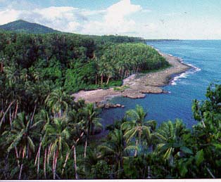 mountain
ranges, deep valleys and swift rivers in
the interior and open plains, tropical forests
and swampy inlets in the coastal region. mountain
ranges, deep valleys and swift rivers in
the interior and open plains, tropical forests
and swampy inlets in the coastal region.
Located just south of the equator, Papua
New Guinea experiences a moderate tropical
climate with high levels of seasonal rainfall.
In the highlands temperatures can range
from a low of four degrees Celsius to a
high of 32 degrees Celsius. The lowland,
coastal and island areas have an average
daily temperature of 27 degrees Celsius.
Papua New Guinea has a population of over
4.4 million people (using 1997 projections
by the National Statistical Office). The
majority live in the highland valleys, many
in isolated villages. Apart from the National
Capital District (NCD), population density
is relatively low.
Around 15 per cent of the population live
in the major urban areas. The major city
and capital of the country is Port Moresby
with a population of about 271,813. Other
large towns and cities include Lae, (population
113,118), Madang (32,1171), Wewak (25,143)
and Goroka (17,269).
|